

History of locational astrology and the bridge between ancient and modern period, part I
Wednesday (Mercury Day) Theory Lesson, 24th of September 2025
From the very beginning of this lesson, it’s important to understand that locational astrology is actually an umbrella term, encompassing all methods of astrology that examine how different locations and places on Earth can influence a person’s experiences, opportunities, and overall life path. In part I of history of locational astrology, the focus will be on everything that was unfolding BEFORE Jim Lewis and innovation of astrocartography as we see it and know today.
Astrocartography is one of the most well-known and widely used branches of locational astrology, which key theme is showing how different locations can affect your experiences, moods, relationships, and life path according to your planetary lines, which are basically an extension of your birth chart.
Other locational methods may focus on relocation charts, local space influence, transits and progressions (cyclocartography), but they all share the same guiding principle: where you are in the world matters, and the planets respond to that context. Within this lesson, history of locational astrology from Marcus Manilius and Ptolemy to mid-20th century astrologers Charles Jayne, Donald Bradley (Garth Allen) and Gary Duncan will be covered, along with must-read books.
Learning goals of this lesson
Locational astrology is as old as astrology itself.
Mesopotamian, Egyptian, and Greek astrologers connected land and sky.
Early maps and texts (like Ptolemy’s Handy Tables) preserved this knowledge.
Manilius gave poetic hints; Ptolemy built a practical system.
Signs and planets were tied to regions, climates, and nations.
Mundane astrology linked celestial events to world affairs.
Cities and countries have charts based on founding dates.
Astrology continued in Medieval and Renaissance times, though often hidden.
The 20th century brought revival through culture, travel, and mobility.
Sepharial’s geodetic maps and Johndro’s systems laid modern foundations.
Eclipse paths became early “locality maps.”
Charles Jayne (Local Space) and Donald Bradley (parans) advanced the practice.
Gary Duncan used computers to automate locational astrology.
This sets the stage for Part II: Jim Lewis and modern AstroCartoGraphy.
Locational astrology exists as long as astrology itself
Long before charts and computers, astrologers were exploring the connection between the land we inhabit and the planets above. They noticed that different places carried different energies, subtly shaping people’s lives, their thoughts and feelings.
The earliest foundations of astrology itself lie in Babylonian and Assyrian practices (2nd millennium BCE), where celestial omens were used for mundane predictions, including weather and political events tied to regions. From Babylonian clay tablets to Egyptian and Greek maps, they traced these patterns across the earth, linking terrain, winds, and cities to the rhythms of the heavens…
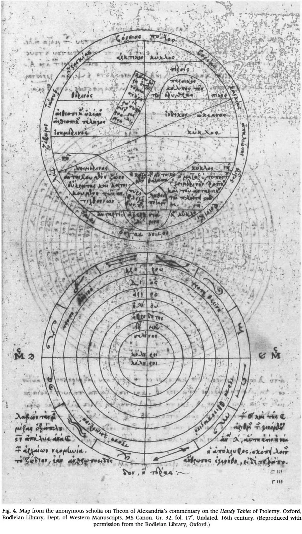
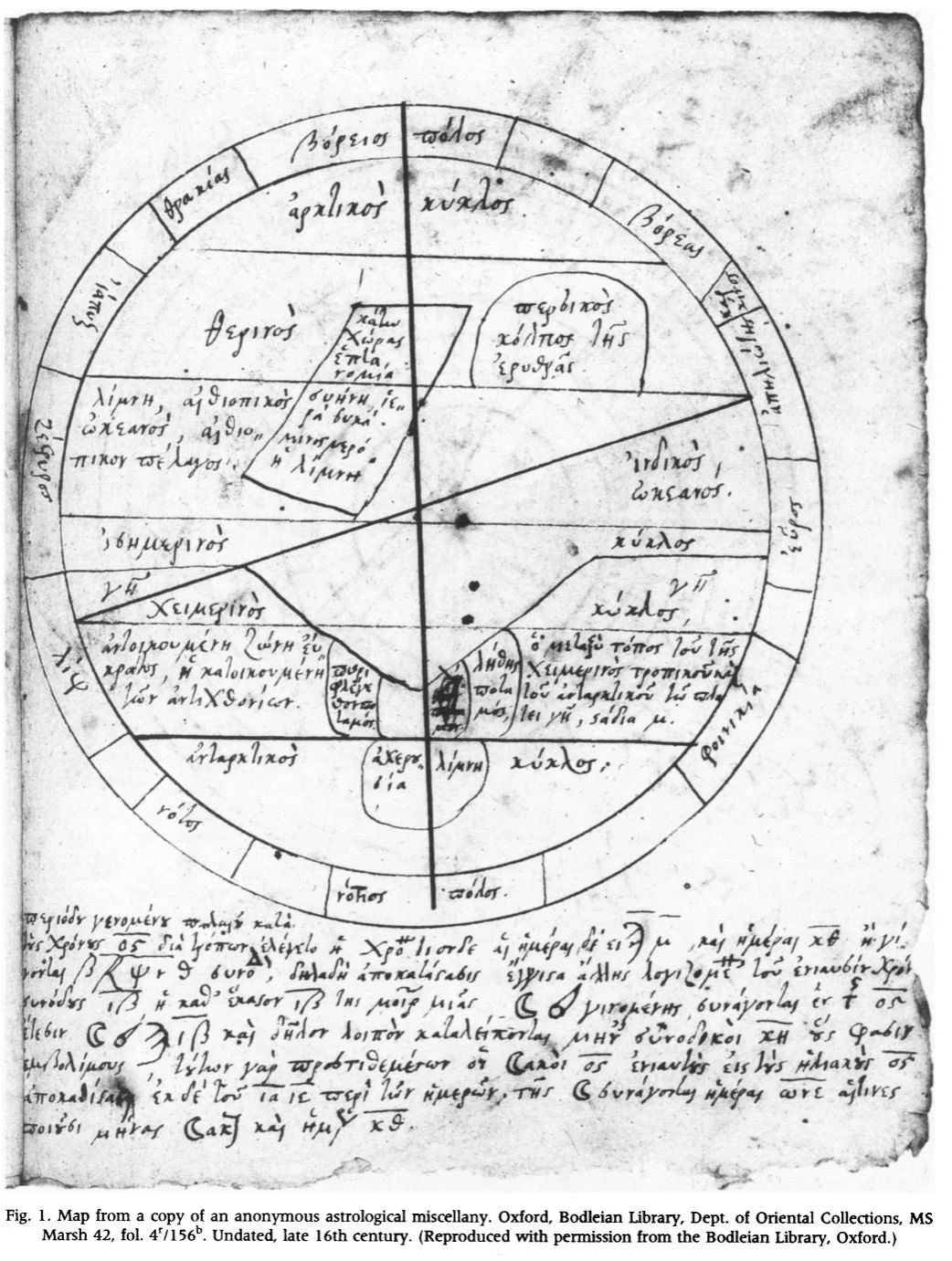

As you can see above, an ancient Greek world map shows a compass, climate bands, towns around Egypt, and even a sketch of the underworld. You’ll also find the same map copied into unattributed margin notes on Theon of Alexandria’s commentary on Ptolemy’s Handy Tables, the practical tables astrologers relied on. It appears inside a bundle of astrological notes, and the same map also turns up in margin notes attached to Ptolemy’s Handy Tables (100 CE – 170 CE). In short, astrologers kept this map as a practical reference when they linked places to planetary meanings.
source: The History of Geographical Map Projections until 1600, Johannes Keuning
Around the same period, a few key writers set down the first practical rules for tying signs and planets to places. The Roman astrologer & poet Marcus Manilius (lived possibly around 27 BCE – 14 CE) outlined zodiacal qualities tied to seasons and regions. Then there is Ptolemy’s Tetrabiblos, the straightforward handbook later astrologers turned to again and again. It laid out a system for how planets and signs behave, and from that system people began asking how those qualities show up in particular lands and climates. That questioning is the seed of what would be discovery of locational astrology.
Explore Manilius + Ptolemy further (click on the images):
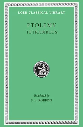
Over time, these early experiments became more systematic. By combining astronomy, geography, and astrology, thinkers like Ptolemy gave later generations a framework to test and refine. What began as observations of winds, climates, and city life grew into a tradition of mapping the sky onto the earth. In the end, these maps and texts show us something simple but profound: people have always looked for meaning in where they live, believing that place and cosmos are inseparably linked. That search laid the groundwork for the locational astrology we recognize today.
Ptolemy is considered the first systematic source for the idea that planetary influence can vary by location.
To wrap it up: Ptolemy’s contribution is practical + structured. Manilius gives poetic, abstract hints about regions and climates, but Ptolemy gives the tools + reasoning that allow astrologers to map celestial influences onto the Earth.
Signs and their ruled regions
Speaking of, his foundational astrological text, Claudius Ptolemy extended celestial influence from individual fate to the character of entire nations and regions in Tetrabiblos. This system, a cornerstone of what we might call ancient locational astrology, proposed a direct correspondence between the zodiac and the known world (oikoumene).
The logic was elegantly schematic. Ptolemy oriented the zodiac onto the map using the four cardinal points. It’s important to note that he did not directly assign the cardinal directions (east, north, west, south) to the signs in a straightforward cartographic sense. Instead, his system was based on the solstices, equinoxes, and the sun's annual journey, which were then metaphorically linked to directions relative to the Greco-Roman world's center (the Mediterranean).
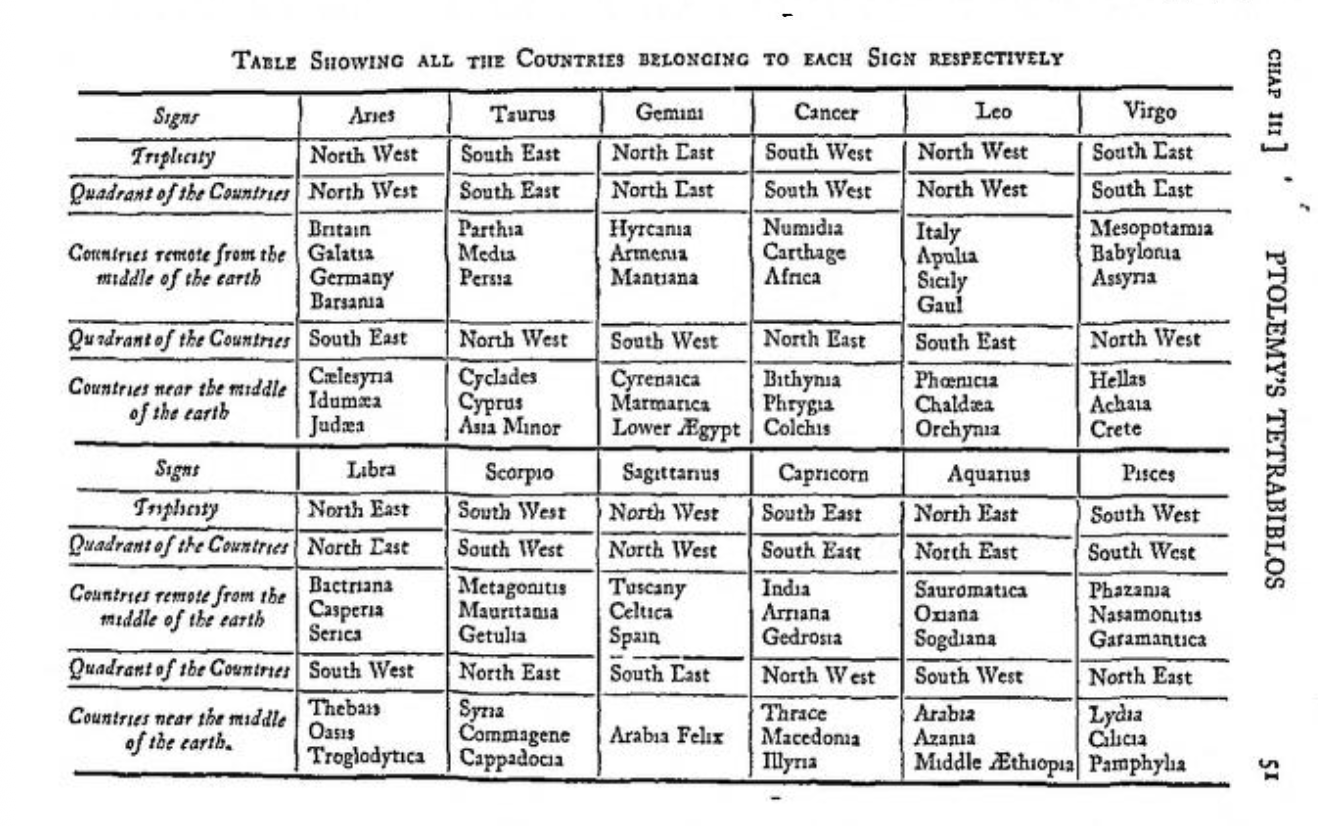
Ptolemy's system of assigning signs to countries is a prime example of Hellenistic Mundane Astrology. He was systematizing a much older tradition into the Greek astrological framework. Mundane astrology is the branch of astrology concerned with world events, politics, and the fortunes of nations (also the original branch of astrology that originated in Mesopotamia, before astrology focused on natal). By understanding which sign ruled a region, an astrologer could theoretically interpret celestial events (like eclipses or planetary conjunctions) as they pertained to that land's fate.
When it comes to Mundane astrology today, every city and country has its own chart and these can play an important role when we think about relocation! If you’re curious about the chart for your own city or country, keep in mind that many places actually have more than one, depending on key historical moments or founding events.
That’s why I always recommend doing some historical digging: trace the important dates, look at turning points, and connect the dots. For larger countries and cities, this information is often easy to find online. But if you live in a smaller place, the data might not be as readily available. In those cases, local museums and archives are invaluable, and some even have digitized records they’ll share with you, while others still keep everything in analog form and you have to do the research in person with them. Usually most museums are very helpful, but of course it depends from where you are from in the world.
Either way, thorough research is key here. The history of a place is the backbone of its astrological chart, and uncovering those details can completely change the way you understand the energy of the land you’re living on or moving to.
Overview of medieval & renaissance period
Astrology didn’t just vanish after the classical world. In Medieval and Renaissance Europe, people were still practicing it, including locational astrology. But there was a big catch: the church had a lot of power at the time, and it wasn’t exactly thrilled about astrology.
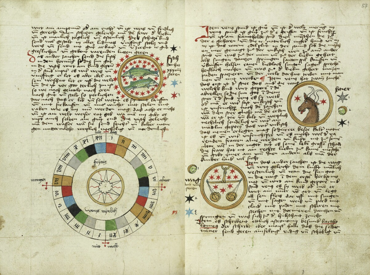
Pisces and Diagram for Friday (left) and Libra and Taurus (right) in an Astronomical Miscellany, shortly after 1464, Ulm or Augsburg, Germany
Astrology was seen as threatening because it suggested the stars could influence human lives, which challenged the Church’s authority about fate being only in God’s hands. Because of that, astrologers often had to work quietly. Some practices went underground, and locational astrology was one of those areas.
That doesn’t mean it disappeared, though. Kings, queens, and nobles often still consulted astrologers, usually in secret. They wanted to know which land would be prosperous, where to build, when to travel, or even which territory to claim. But for everyday people, it wasn’t something you could openly study or practice without risking trouble.
So while locational astrology survived through that period, it was more hidden, less written about, and definitely not taught openly the way it is today. That’s why when you look at historical sources, there’s this gap that the knowledge didn’t vanish, it was just carried quietly until it could resurface more freely in modern times.
What this shows is that astrology, and locational astrology in particular, has always had a remarkable persistence. While the Church’s authority forced much of it underground, the knowledge was never lost. People still sought its guidance, and practitioners found ways to keep it alive. That endurance is part of why we can study it so openly today, because it proved itself too valuable to ever be erased…
The revival of locational astrology in the 20th century
Astrology experienced a resurgence in the 20th century, transitioning from a suppressed practice to a more widely accepted one. This revival was influenced by three key factors: cultural shifts, technological advancements, astrological innovations.
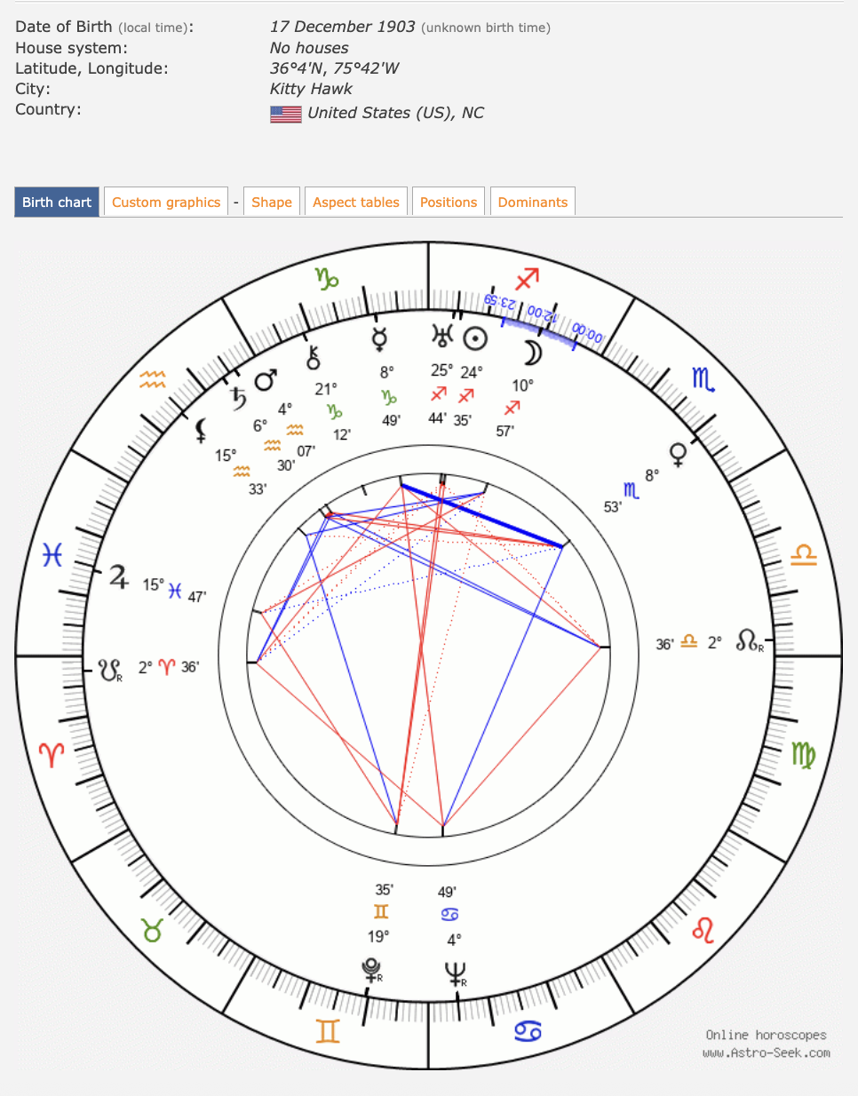
As briefly mentioned in our first theoretical lesson, it’s time to go a bit deeper down the rabbit hole today: On December 17, 1903, Orville and Wilbur Wright achieved the first powered, sustained, and controlled air flight in Kitty Hawk, North Carolina. This monumental event marked the dawn of the aviation age, symbolizing human innovation and the breaking of boundaries.
In the context of locational astrology, this date is quite important as it represents a time when the world began to shrink, and the ability to relocate became more feasible. The increasing mobility allowed individuals to consider how different locations could impact their astrological charts, leading to a greater interest in locational astrology. Yet, this is a bit slowed down thanks to the two world wars (1914-1918 + 1939-1945). In between two world wars, there was a brink of technological growth…
The technical innovation - from geodetics to angularity
To understand the evolution of modern locational astrology, it is essential to begin with the foundational work of Sepharial (the pseudonym for Walter Gorn Old), a renowned British astrologer and theosophist working in the early 20th century. He represents the first serious attempt to create a systematic, mathematical method for projecting celestial influences onto a world map since the time of Ptolemy. Sepharial was essentially trying to answer the ancient question of how the zodiac relates to geography, but with the precision of modern cartography.
Sepharial's core idea, the Geodetic Equivalent, was elegantly simple in its logic. He proposed a direct correspondence between celestial longitude and terrestrial longitude. He superimposed the 360 degrees of the zodiacal ecliptic onto the 360 degrees of the Earth's equator. To do this, he needed an anchor point, a terrestrial location that would correspond to 0° Aries, the starting point of the tropical zodiac. Sepharial chose the Greenwich Meridian (0° longitude) as this anchor, effectively aligning the Prime Meridian with the First Point of Aries.
If a planet is at 15° Taurus in the sky...
...you find its place on Earth by counting the degrees from the start.
First, you go through all 30 (0-29) degrees of Aries, then 15 degrees into Taurus.
That's a total of 45 degrees from the starting point (0° Aries).
So, the "geodetic equivalent" of that planet would be at 45° East Longitude on the map.
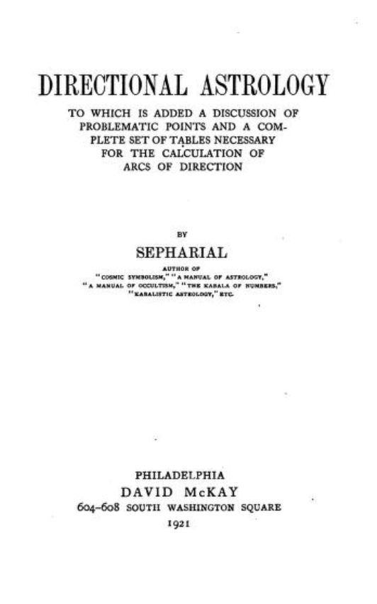
A must read (click on the picture to access the book)
While Sepharial provided the initial "map," Edward Johndro designed the "engine" that would power modern locational astrology. His 1929 book that emerged in between the two world wars, The Earth in the Heavens, was the result of two decades of research and presented a system that was far more complex, precise, and personally powerful than the Geodetic Equivalent.
Johndro's work was revolutionary because it shifted the question from "what is the general energy of this place?" to "how will this specific location activate the unique potential in my birth chart?"
He provided the sophisticated mathematical and theoretical blueprint that Jim Lewis would later simplify and automate with computers to create the user-friendly AstroCartoGraphy maps we know today. While Lewis made it accessible, Johndro did the heavy lifting to make it astrologically valid.
The mid-20th century bridge: from eclipse paths to the first astro maps
The period between the mid-1940s and 1960s was the essential incubator for modern locational astrology. After the theoretical work of Sepharial and Johndro, a new generation of astrologers began experimenting with ways to visualize planetary influences on a map. This shift from complex calculations to interpretable maps was the critical, major step that made the concept accessible as we know it today.
The starting point were eclipse path maps
The simplest and most widely recognized form of a "locality map" in astrology have been the paths of eclipses.
Astronomers and astrologers have long mapped the narrow band across the Earth's surface where a solar or lunar eclipse is visible. In mundane astrology (the astrology of world events), it's a fundamental principle that eclipses trigger significant events in the regions over which they pass.
Eclipse maps provided a ready-made, intuitive model. They visually demonstrated that a specific event did not affect the entire globe uniformly, but had a focused "zone of influence." This directly paved the way for the idea that planetary energies in a natal chart could also have specific terrestrial zones.
Recommended read: Mundane Astrology by Michael Baigent, Nicholas Campion, and Charles Harvey (1984, revised 1995).
Get to know the pioneers, Charles Jayne & Donald Bradley (Garth Allen)
Earlier astrologers like Sepharial and Johndro that we mentioned established the mathematical and philosophical basis, but their methods were often too complex for the average astrologer to calculate and use regularly. The field needed a bridge from theory to practice.
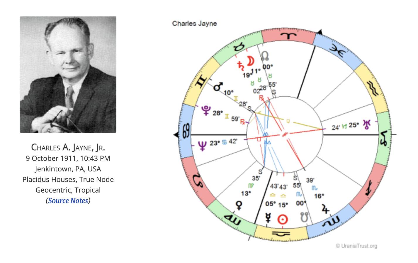
Jayne and Bradley/Allen (his pen name) built that bridge by creating two different, but equally innovative, visual and interpretive models.
Charles Jayne (1911-1985) was a key figure and mentor in the development of Local Space astrology. He influenced Michael Erlewine and others to explore horizon-based coordinate systems, leading to one of the most innovative systems of locational astrology of the late 20th century.
Instead of working with longitude and latitude (a global grid), Jayne's system was based on azimuth and altitude, the local horizon coordinate system.
He would calculate the compass direction (azimuth) and height above the horizon (altitude) for each planet for an individual's birth. We will discuss this more in lessons dedicated specifically to Local Space Astrology.

Garth Allen/ Donald Bradley (focused heavily on the concept of parans (paranatellonta, from the Greek for "stars rising alongside"), the simultaneous rising, setting, or culminating of planets as seen from a specific location.
He understood that Johndro's complex calculations could be simplified and popularized. His most famous contribution to locational astrology was his analysis of the 1961 plane crash of UN Secretary-General Dag Hammarskjöld.
Allen demonstrated that the crash site was where Hammarskjöld's Ascendant (representing the self) was in a powerful paran with Pluto (death/transformation).
This single case study, published in American Astrology Magazine, provided a dramatic, real-world "proof of concept" that captivated the astrological community and demonstrated the potent reality of locational techniques.
Garth Allen's columns took dense, technical ideas and made them exciting and relevant for a mainstream astrological audience. He created the demand for the kind of easy-to-generate maps that would soon follow.
Together, they provided the method + narrative that turned locational astrology from an obscure academic idea into a dynamic and compelling practice, directly paving the way for the computer-generated maps that we use today.
Finalizing with Gary Duncan, the digital innovator
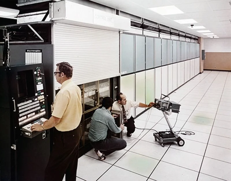
Mid-20th century computer
In 1966, computers were room-sized, expensive machines primarily used by universities, large corporations, and the military. The idea of using one for personal astrology was radical. Gary Duncan (1931-1988), working with this nascent technology, achieved a world-first: he automated the incredibly complex calculations required to project a natal chart onto a world map.
For Duncan, this map was likely a demonstration of how computing power could eliminate human error and bias from astrological calculation. It was a step towards his goal of making astrology "above the reproach of the scientific community."
His connections to figures like Llewellyn George and, crucially, Donald Bradley (Garth Allen) and Cyril Fagan placed him at the epicenter of the most advanced astrological research of the era.
Bradley and Fagan were revolutionaries focused on sidereal astrology and empirical validation. He began conducting statistical investigations with them while still in high school.
The astro map was just one application. His true legacy lies in his statistical approach…
Massive data sets - he did studies on 43,000 psychologists, 8,928 members of Congress, and 6,281 baseball players were unprecedented in scale. This was "big data" astrology decades before the term existed.
Duncan challenged dogma - his most important contribution may have been his work on angular separations. By using laser printers (another first) to show that statistically significant peaks occurred at non-traditional angles (like 79° instead of 90°), he dared astrologers to let the data, not tradition, dictate their methods.
GRR! (Grass Roots Research) - his plan to use home computers and volunteers to build vast databases was truly visionary. It foreshadowed modern citizen science and collaborative research projects.
Gary Duncan was arguably ahead of his time. He possessed the knowledge, tools, and vision to create a truly scientific astrology. His computerized astromap was a tangible product of that vision, demonstrating the power of technology to execute complex locational calculations flawlessly.While Jim Lewis would later popularize the application of this technology with AstroCartoGraphy, Gary Duncan laid the scientific + computational foundation. He was the rigorous researcher who proved it was possible, setting the stage for the innovators who would make it accessible to the world. Part II will cover the evolution of locational astrology from Jim Lewis up to the present, and explore the directions it may take in the future.
…from ancient practice to modern maps
So, what have we covered today? Locational astrology has been with us since the very beginning of astrology. From the structured systems of Ptolemy to the poetic hints of Manilius, people have long explored how the stars interact with the places we live. Even when astrology went underground during the Medieval and Renaissance periods, its practice continued quietly, proving how valuable and enduring it truly is.
Fast forward to the 20th century, and the field began to bloom again. Sepharial, Johndro, Jayne, Bradley, and finally Gary Duncan all contributed to turning locational astrology into a precise, practical, and eventually computer-assisted practice. This set the stage for Jim Lewis and modern AstroCartoGraphy, which allows us to explore how locations around the world can shape our lives in meaningful ways.
The takeaway? Across time, people have sought to understand the connection between the sky and the places we inhabit. That curiosity hasn’t changed, and it’s what continues to make locational astrology such a powerful tool today.
~Until the following practical lesson~
